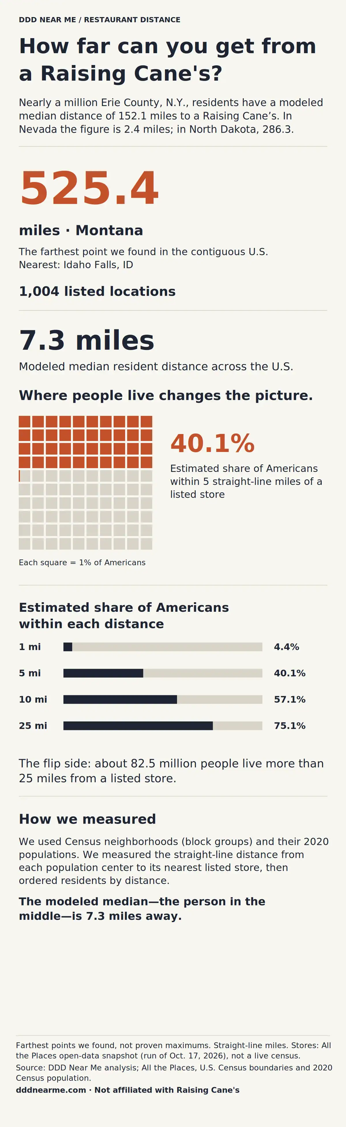
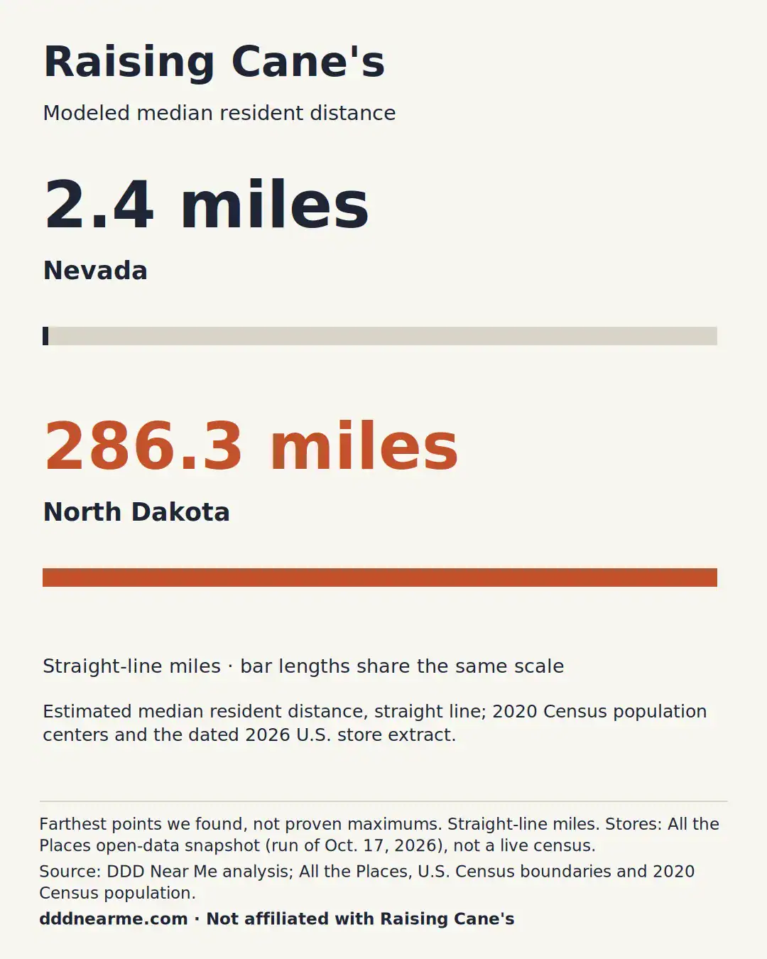
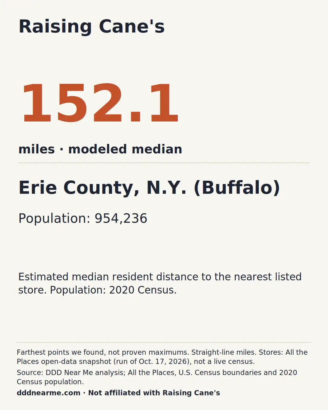
Nearly a million Erie County, N.Y., residents have a modeled median distance of 152 miles to a Raising Cane’s. In Nevada the figure is 2.4 miles; in North Dakota, 286.


Half of Americans are within 7.3 miles
Only 1.8% of the land in the lower 48 is within 5 miles of a Raising Cane's, but an estimated 40.1% of Americans live that close.
We took about 240,000 Census neighborhoods (block groups) with their 2020 populations and measured the straight-line distance from each one to its nearest Raising Cane's. Then we lined up all 331 million Americans by that distance. The person in the middle is 7.3 miles away. About 4.4% live within 1 mile, and about 82.5 million people (24.9%) live more than 25 miles from one.

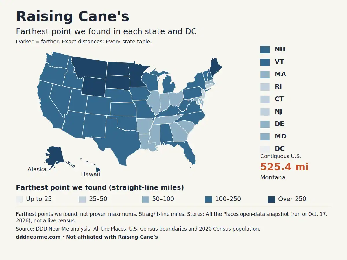
How distance changes by state


States with the smallest gaps from a Raising Cane's
- District of Columbia — 7.5 mi
- Connecticut — 40.6 mi
- Rhode Island — 40.6 mi
- New Jersey — 45.3 mi
- Delaware — 57.2 mi
States with the largest gaps from a Raising Cane's
- Alaska — 1500.3 mi
- Hawaii — 1354.3 mi
- Montana — 525.4 mi
- North Dakota — 513.7 mi
- South Dakota — 371.5 mi
State rankings include DC, which is not a state. Each distance is the farthest point we found in that state, measured in a straight line to the nearest listed location.
Every state
| State | Locations | Farthest point we found | Nearest location to that spot |
|---|---|---|---|
| Alabama | 5 | 105.3 mi | Birmingham, AL |
| Alaska | 4 | 1500.3 mi | Anchorage, AK |
| Arizona | 45 | 185.6 mi | Rio Rancho, NM |
| Arkansas | 9 | 99.8 mi | University, MS |
| California | 145 | 155.9 mi | Redding, CA |
| Colorado | 23 | 218.0 mi | Spanish Fork, UT |
| Connecticut | 6 | 40.6 mi | Warwick, RI |
| Delaware | 2 | 57.2 mi | Dover, DE |
| District of Columbia Smallest gap | 2 | 7.5 mi | Washington, DC |
| Florida | 33 | 166.1 mi | Homestead, FL |
| Georgia | 15 | 80.5 mi | Athens, GA |
| Hawaii | 9 | 1354.3 mi | Schofield Barracks, HI |
| Idaho | 5 | 182.9 mi | Idaho Falls, ID |
| Illinois | 46 | 88.4 mi | Marion, IL |
| Indiana | 14 | 68.0 mi | Bloomington, IN |
| Iowa | 10 | 112.7 mi | Sioux City, IA |
| Kansas | 8 | 203.1 mi | Colorado Springs, CO |
| Kentucky | 16 | 104.1 mi | Athens, OH |
| Louisiana | 63 | 82.4 mi | New Orleans, LA |
| Maine | none | 326.3 mi | Concord, NH |
| Maryland | 11 | 81.7 mi | Dover, DE |
| Massachusetts | 11 | 68.4 mi | Fall River, MA |
| Michigan | 9 | 237.5 mi | Wausau, WI |
| Minnesota | 17 | 277.5 mi | Saint Cloud, MN |
| Mississippi | 14 | 98.9 mi | Madison, MS |
| Missouri | 23 | 103.3 mi | Arnold, MO |
| Montana Largest gap | none | 525.4 mi | Idaho Falls, ID |
| Nebraska | 17 | 188.7 mi | Fort Collins, CO |
| Nevada | 23 | 214.0 mi | North Las Vegas, NV |
| New Hampshire | 2 | 145.1 mi | Concord, NH |
| New Jersey | 10 | 45.3 mi | Glassboro, NJ |
| New Mexico | 6 | 178.7 mi | Rio Rancho, NM |
| New York | 14 | 239.5 mi | Simsbury, CT |
| North Carolina | 8 | 106.9 mi | Greenville, NC |
| North Dakota | none | 513.7 mi | Sioux Falls, SD |
| Ohio | 65 | 68.6 mi | Athens, OH |
| Oklahoma | 22 | 157.6 mi | Wichita, KS |
| Oregon | 3 | 189.9 mi | Redding, CA |
| Pennsylvania | 17 | 110.0 mi | State College, PA |
| Rhode Island | 2 | 40.6 mi | Warwick, RI |
| South Carolina | 5 | 91.5 mi | Statesboro, GA |
| South Dakota | 1 | 371.5 mi | North Platte, NE |
| Tennessee | 18 | 79.3 mi | Tupelo, MS |
| Texas | 202 | 209.0 mi | Odessa, TX |
| Utah | 13 | 216.4 mi | Rio Rancho, NM |
| Vermont | none | 153.9 mi | Concord, NH |
| Virginia | 17 | 108.9 mi | Greensboro, NC |
| Washington | 5 | 153.7 mi | Spokane, WA |
| West Virginia | 1 | 128.4 mi | Greensboro, NC |
| Wisconsin | 8 | 157.8 mi | Wausau, WI |
| Wyoming | none | 310.9 mi | Fort Collins, CO |
Share these
Download the infographic, the story graphics or the state map. Please keep the source credit visible.
Source: DDD Near Me analysis of All the Places open-data store snapshot (run of Oct. 17, 2026), U.S. Census state boundaries and 2020 Census population. Straight-line miles.
dddnearme.com · Not affiliated with Raising Cane's
How we calculated this
- Locations: 1,004 U.S. Raising Cane's locations from the All the Places open dataset (CC0), which collects each chain’s public store directory (run of October 17, 2026). It is an open-data snapshot, not a live census: stores that opened, closed or were missing from the directory that day are not reflected.
- Distance: straight-line miles (“as the crow flies”), not driving. Driving distances are longer.
- Farthest point we found: we tested points roughly every two-thirds of a mile across each state (closer together in small states, about every 3 miles in Alaska) inside the Census Bureau’s 2023 state boundaries, then searched more closely around the farthest ones. On Oct. 30, 2026 we also checked every coastline and island in the Census 1:500,000 boundaries, which added small islands the grid had missed, such as Florida’s Dry Tortugas. These are the farthest points we found, not proven maximums. Locations across state lines count; locations in Canada and Mexico do not.
- People: “Estimated share of Americans within 5 miles” and “typical distance” use the 2020 Census population center of every block group (about 240,000 neighborhoods).
- Farthest points often land in wilderness, on lakes or on small islands with no roads.
Which of these 12 chains leaves the smallest gaps? Compare Raising Cane’s with the other 11 chains.
Download the data
how-far-from-raising-canes-by-state-v2.csv covers all 50 states plus D.C.: the farthest point we found, miles to the nearest Raising Cane's, the median distance, the location count, the store snapshot date and a note on each row (rows changed by the Oct. 30 boundary recheck say so).
Licensed CC BY 4.0. Please credit this page with a link.
Sources: All the Places (alltheplaces.xyz); U.S. Census Bureau cartographic boundary files and 2020 Census block-group population centers. Not affiliated with Raising Cane's.